PLANTS | ANIMALS | ECOLOGY | FUNGI | GEOLOGY | GARDENING | TOOLS
MEXICAN PLANTS & ANIMALS HOME

Excerpts from Jim Conrad's
Naturalist Newsletter
from the April 24, 2011 Newsletter issued from Hacienda Chichen Resort beside Chichén Itzá Ruins, central Yucatán, MÉXICO; limestone bedrock, elevation ~39m (~128ft), ~N20.676°, ~W88.569°
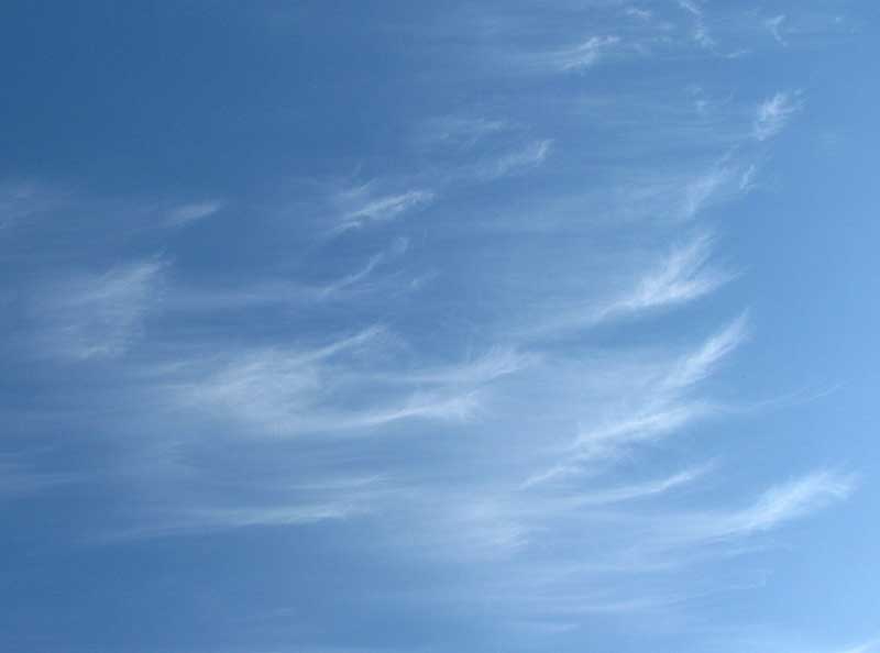
CIRRUS UNCINUS CLOUDS
Here in the tropics I hadn't expected to see many cirrus clouds -- what I called "mare's tails" as a kid back in Kentucky -- because I knew that they're very high clouds formed of ice crystals. Generally they form at an altitude above 26,000 feet (8,000 m). However, in the tropics clouds as high as other places, and when they're that high they'll be formed of ice crystals, and cirrus clouds are likely to form. They form at temperatures of about -40 to -50°F (-40 to -50°C).
The other day in the sky over Pisté I saw the ones at the top of this page.
In general cirrus clouds are wispy looking, and so thin that the sun shows through them. Wikipedia says that six distinct subforms of cirrus clouds are recognized: Cirrus castellanus, Cirrus fibratus, Cirrus radiatus, Cirrus spissatus, Cirrus uncinus, and Cirrus intortus. Using Google's image-search function and searching on the various names, soon it became apparent that the clouds in the picture are Cirrus uncinus. In Latin "uncinus" means "hooked," so Cirrus uncinus are cirrus clouds with a hook at the end. Often the hooks are much more apparent than in our examples.
In the Temperate Zone Cirrus uncinus clouds often indicate the approach of a warm or occluded front, though I'm not sure that that holds up here. I read that you can tell which way the wind is blowing by noticing the direction in which the ice crystals align their streaks. However, the clouds in my picture, though seeming to be moving toward the picture's right, we're being carried en masse toward the bottom of the picture. That day hot air from the south, from over Guatemala and Chiapas, was gushing over us, so clearly different air layers were moving in different directions.
Also I read that if you have just a few clouds like these, in terms of forecasting the weather, really they don't mean much of anything. Often it's just that the constantly changing atmosphere at that particular moment was briefly configured in such a way that ice crystals arrayed themselves into cirrus clouds.