PLANTS | ANIMALS | ECOLOGY | FUNGI | GEOLOGY | GARDENING | TOOLS
MEXICAN PLANTS & ANIMALS HOME

Excerpts from Jim Conrad's
Naturalist Newsletter
from the December 14, 2014 Newsletter issued from Río Lagartos, on the Yucatan Peninsula's northern coast (~N21.60°, ~W88.16°), Yucatán state, MÉXICO
THE RUINS OF EMAL
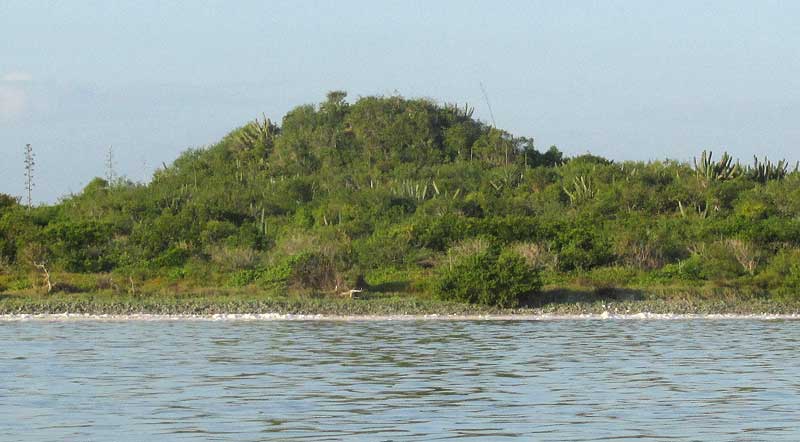
Maybe 15kms up the Ría Lagartos Estuary from Río Lagartos, our flamingo tour crew decided to visit Emal. There on the estuary's shore, Emal catches your attention from far off because an ancient Maya ruin rises well above any other feature in the region's flat, near-sea-level landscape. Above, you can see the scrub- and cactus-mantled archaeological mound.
The ruins are from a time when Pre-Columbian Maya collected salt from the surrounding salt pans -- as still is done on a large commercial scale. The salt probably was traded throughout much of Mesoamerica -- approximately from central Mexico to northern Costa Rica. Some think that Chichén Itzá's grandeur and power were based on its control of the salt trade, and Emal was their main salt source.
However, the ruins at Emal are so modest that it's hard to believe that the site was so important. Some archaeologists reason that this can best be explained by Emal having been under firm control of a distant power -- probably Chichén Itzá. Maybe Chichén Itzá's leadership used Emal's salt strictly to enhance their own power and glory.
These are fascinating thoughts, but so far they are only guesses.
During our visit to Emal, a new-to-me cactus grew on the ruins. When I identified it, it turned out to be rare and somewhat out of place in this area, being more at home farther south in Guatemala and Chiapas, so I began digging for more information. That's how I stumbled upon a webpage entitled "Emal Archaeological Project," where the Project's leader wrote, "Here you will find all of our field data, journals, publications, maps, and other information." The information there offers fascinating glimpses into how the world of Maya archaeology works. There are field maps, notes on funding efforts (from the National Geographic Society), videos of previous work being done there, and the full project proposal (in Spanish). The webpage is at https://sites.google.com/site/emalarchaeologicalproject/.
Elsewhere on the Internet the 2005 book by Susan Kepecs and Rani Alexander entitled The Postclassic to Spanish-era Transition in Mesoamerica: Archaeological Perspectives tells us that according to the ancient native books of Chilam Balam, during times of the Maya Empire Emal was ruled by the Chan lineage. The Chans of Emal maintained a lose economic alliance with kin in southern Quintana Roo, on the Yucatan Peninsula's Caribbean coast. Both Chan groups were called "the guardians of the sands, the guardians of the seas." Kepecs and Alexander say that in the late 1400s the Quintana Roo Chans specialized in building large trade canoes, which must have carried salt and other goods around the peninsula to ports on the Gulf of Mexico and as far south as Honduras.
It'll be fun keeping up with the Emal Archaeological Project through postings on the above web page. Maybe we'll even get to meet some of the archaeologists. The thought has arisen that maybe my rare cactus grew upon the ruins at Emal because ancient Maya canoes coming to Emal for salt brought the cactus's ancestors up from Guatemala. That's conceivable, because the cactus's fruits are good to eat.