PLANTS | ANIMALS | ECOLOGY | FUNGI | GEOLOGY | GARDENING | TOOLS
MEXICAN PLANTS & ANIMALS HOME

Excerpts from Jim Conrad's
Naturalist Newsletter
from the September 11, 2011 Newsletter issued from Mayan Beach Garden Inn 20 kms north of Mahahual; Caribbean coastal beach and mangroves, ~N18.89°, ~W87.64°, Quintana Roo state, MÉXICO
PREDAWN RAIN ON THE YUCATÁN'S EASTERN COAST
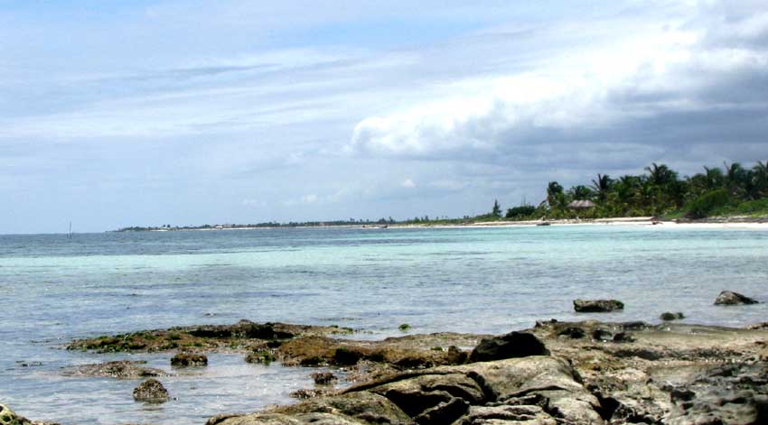
As we approach the peak of this year's rainy season's raininess, I'm understanding how it works here on the Yucatán Peninsula's eastern coast. It's very different from what happens in the peninsula's interior, where the rainy season is expressed in terms of heavy, often violent afternoon thunderstorms. In the interior, mornings begin clear, by midmorning it's clouding up, then by mid afternoon storms break out here and there, maybe right over you. The peak comes in September and October. At the top of this page you can see a typical mid-afternoon view from our northern rocky point toward the south, showing storm clouds building over land but not over sea.
Here on the peninsula's eastern coast prevailing winds blow from off the ocean in the east, so those interior storms that form to our west just drift farther westward. During the interior's rainy afternoons, storms don't form over us or the water because it's much cooler on and beside the ocean, and for storms to form you need stark temperature differences. You need warm surface air to bubble up through cooler air, to high altitudes.
For the last two or three months, even as afternoon rains drenched the interior, for the most part it's stayed dry here on the coast. Rains mostly came when tropical depressions or "areas of disturbed weather" formed in the Caribbean, then wandered over us, sometimes dumping several inches of rain over a period of days.
Lately a new trend has begun and Marcia says it'll develop more fully until things really get soggy in October. That is, right before dawn, storms or showers form out over the water and drift over us. What's happening is that during the night air over the water cools dramatically, but the ocean water remains warm - - about 86°F (30°C) off our coast.
Therefore, right before dawn, air immediately over the warm water starts bubbling up through the night-cooled air above it, until it reaches an altitude where condensation occurs. Then rain falls as the cloud drifts over us, sometimes lots of rain, with lightning and thunder, just about when I'm jogging.