PLANTS | ANIMALS | ECOLOGY | FUNGI | GEOLOGY | GARDENING | TOOLS
MEXICAN PLANTS & ANIMALS HOME

Excerpts from Jim Conrad's
Naturalist Newsletter

from the September 4, 2011 Newsletter issued from Mayan Beach Garden Inn 20 kms north of Mahahual; Caribbean coastal beach and mangroves, ~N18.89°, ~W87.64°, Quintana Roo state, MÉXICO
ANVIL-HEAD THUNDERSTORM
That morning as I began jogging the stars were shining, with the merest glow of dawn off toward the east, over the ocean. When it grew lighter clouds began showing up as silhouettes and I could see that that day there was a good bit of "vertical development" -- columnar clouds all around the horizon soaring skyward. That meant lots of instability in the air, maybe leading to nice storms later in the day.
As the sky lighted up, one columnar cloud in particular caught my attention, its roiling, cauliflower-like top billowing upward fast, and vertical lightning starting to flash within, eventually ever ten seconds or so. As the sun rose, colors and luminosity of back-lighted clouds intensified, even as the air grew more electric. A magnificent thunderstorm was forming and I couldn't take my eyes from it all.
At a certain point any storm-cloud punching upward through the troposphere toward the stratosphere enters such thin air that the rising cloud spreads outward because the pressure at the sides is low as well as above; eventually the cloud becomes anvil shaped. Cumulus clouds producing rain are called cumulonimbus, and cumulonimbus with anvil-top shapes are called CUMULONIMBUS INCUS, "incus" being Latin for "anvil."
Back at Marcia's, just as my jog ended, our cloud got its anvil-head, and I got its picture, which is shown at the top of this page.
I can't see an anvil-head cumulonimbus without remembering Joe Putnam, my first roommate in college back in 1965, who one day came in from Climatology and asked me if I'd ever had a good view of a fully formed anvil-head thunderstorm. Before blurting out that like everyone else I'd seen dozens of them if not hundreds, it occurred to me that with Joe this might be a trick question. So, I tried to remember the last well formed one I'd actually had a good view of. I couldn't. I'd seen lots of them in books, mostly shot from airplanes, but, no, when I got to thinking about it, really I couldn't remember having ever having enjoyed a clear view of a fully formed anvil head, not in my whole life.
Joe was disappointed that he hadn't caught me. Then he explained that in our part of the world, the eastern US's humid interior, anvil head clouds were nearly always mostly or entirely obscured by haze or other clouds clustering around them. To have a good view of a fully developed anvil head, I needed to go west to more arid land, or south to Florida.
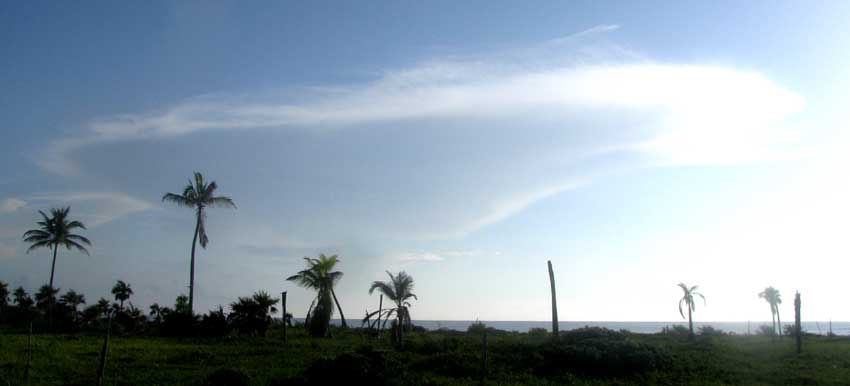
Speaking of lack of haze, right after taking the above picture I snapped a shot straight into the rising sun, which shows isolated, very distant clouds between us and the sun, visible because of lack of haze. See below:

What I haven't figured out yet is why we have so little haze here over ocean water, and so much over dry land in places like eastern North America.
About an hour later, the thunderhead no longer thundered, and no rain fell below it. Its luminous head was spreading and dissipating, as shown below: