
PLANTS | ANIMALS | ECOLOGY | FUNGI | GEOLOGY | GARDENING | TOOLS
Excerpts from Jim Conrad's
Naturalist Newsletter
from the November 10, 2013 Newsletter issued from the Frio Canyon Nature Education Center in the valley of the Dry Frio River in northern Uvalde County, southwestern Texas, on the southern border of the Edwards Plateau; elevation ~1750m (~5750 ft); N29.62°, W99.86°; USA
CIRROCUMULUS UNDULATUS
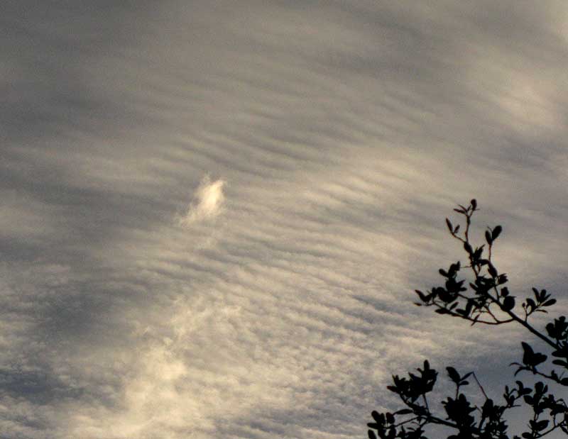
Thursday morning the sun rose behind a thin cloud cover that in one part of the sky broke into the interesting pattern shown above.
We've seen such rippled patterns before, as in April of 2011 when they appeared over my hut in the Yucatan. You can see those, which we identified as Altocumulus undulatus, at https://www.backyardnature.net/yucatan/undulatu.htm.
Our clouds this week also are of the "undulatus" kind, but you can see that the Yucatan ripples, or "undulations," are much larger and thicker than this week's cloud. That's because this week's clouds are higher in the sky, probably composed of ice crystals instead of the usual water vapor, and therefore are wispier.
High-altitude, wispy cloud-curdles are cirrocumulus clouds, so the ones in our picture are CIRROCUMULUS UDULATUS. Cirrocumulus undulatus clouds seldom cover the entire sky, but rather appear only in patches, as did ours. Though our clouds were produced as a cold wave was passing through, Cirrocumulus undulatus are known to occur throughout the year, though they are never frequent or widespread. Often they're hidden by lower clouds, thus they may be more often seen from jet windows than from the ground.
The occurrence of this cloud type isn't helpful for predicting the weather, but they do often occur where there's instability in the air, and cirrocumulus clouds in general are associated with large weather systems such as the cold front that was moving through last Thursday morning.