
PLANTS | ANIMALS | ECOLOGY | FUNGI | GEOLOGY | GARDENING | TOOLS
Excerpts from Jim Conrad's
Naturalist Newsletter
from the August 16, 2009 Newsletter, reporting on a visit to Crater Lake National Park in southwestern Oregon:
CRATER LAKE NATIONAL PARK
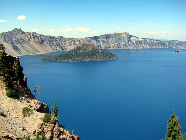
This week Roland and Anita invited me on an overnight camping trip to Crater Lake National Park in the Cascade Mountains about 75 air-miles WNW of here. The crater, about five miles across (8 kms), was formed some 7,700 years ago by a volcanic eruption. The eruption created a 12,000-ft-high mountain (3650 m) now called Mt. Mazama, but so much magma was ejected that the mountain eventually collapsed, leaving the crater. That's a view across the crater's western end above.
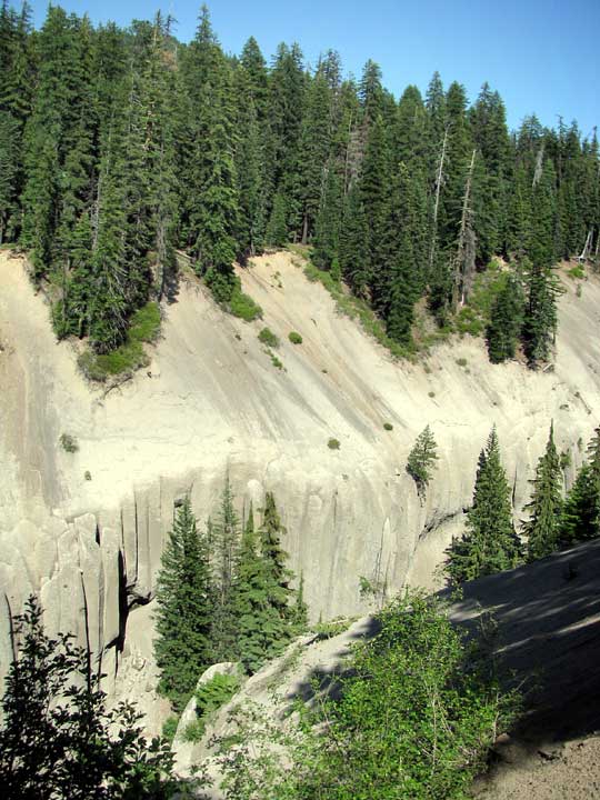
That's Wizard Island in the picture, a volcanic cone formed after the collapse. With a maximum lake depth of 1943 ft (592 m), Crater Lake is considered the deepest lake in the US. I took the picture from an elevation of 7,100 ft (2164 m). Five miles from the crater, ash deposits still are very thick, as shown by a narrow, steep-walled valley eroded into ash below.
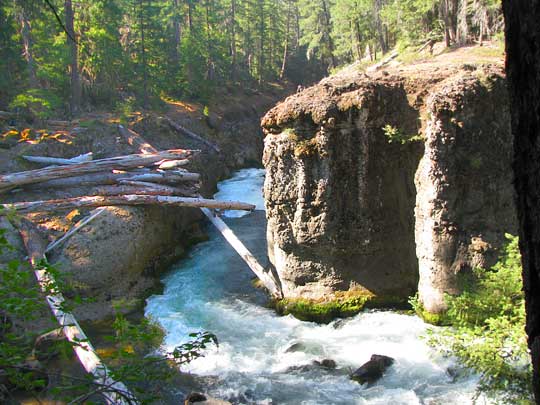
Our region's main river, the Rogue, arises in the crater's vicinity. I hiked about ten miles of the Upper Rogue River Trail paralleling the river. You can see Takelma Gorge some 15 miles from the crater where the Rogue cuts through stacked layers of ancient mudflows and debris from off the volcano below:
Crater Lake's Wikipedia page does a good job exploring the area's very interesting geology at https://en.wikipedia.org/wiki/Crater_Lake_National_Park.