
PLANTS | ANIMALS | ECOLOGY | FUNGI | GEOLOGY | GARDENING | TOOLS
Excerpts from Jim Conrad's
Naturalist Newsletter
from the February 16, 2009 Newsletter, issued from the forest near Natchez, Mississippi; elevation ~400ft (120m), ~N31.47°, ~W91.29°:
BAYOU WALKING
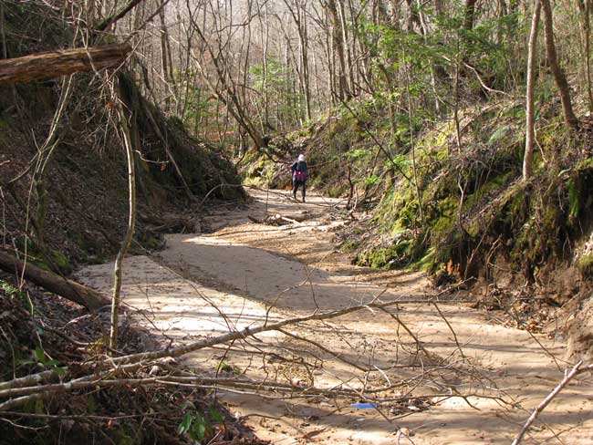
In most of the US bayous are thought of as small, slow-moving streams or creeks, or lakes associated with the Deep South's swamps and rivers. Around here bayous are something else entirely. Most people outside the region would refer to our bayous as deep, steep-walled, sandy-bottomed gullies or ravines that usually are dry, except after rains. That's Karen hiking down the bayou below her house above.
Our bayous are peculiar to a very particular kind of landscape -- a fast-eroding upland mantled with a thick layer of loess, which is dust deposited by wind at the end of the last ice age. Our loess-mantled upland is eroding fast -- in geological terms -- because it's right next to the Mississippi River floodplain. This gives water running off our upland a steep gradient, so it runs off fast, eroding.
Loess erodes to a "high angle of repose," which means that in many places our bayous have vertical walls. If there's a vertical loess wall facing north in the bottom of a sheltered bayou, you get a shadier- and moister-than-usual habitat where mosses, ferns, liverworts and delicate wildflowers feel at home.
If you want to know more about how our loess hills I've produced several pages on the topic at https://www.backyardnature.net/loess/index.htm.