PLANTS | ANIMALS | ECOLOGY | FUNGI | GEOLOGY | GARDENING | TOOLS
MEXICAN PLANTS & ANIMALS HOME

Excerpts from Jim Conrad's
Naturalist Newsletter
notes from the May 3, 2015 Newsletter describing a camping trip in the forest south of Las Vigas in northern Veracruz, México
SAN JUAN DEL MONTE ECOLOGICAL RESERVE
In our April 12th Newsletter I described visiting San Juan del Monte Ecological Reserve in the mountains of northern Veracruz state. That Newsletter is at www.backyardnature.net/n/15/150412.htm.
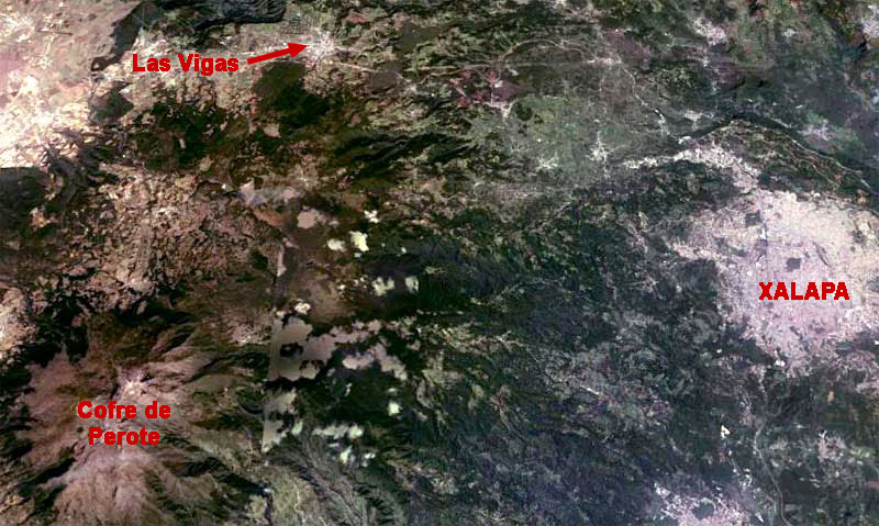
Now I can better introduce you to that nice place. First, above, take a look at the area as seen from Google Earth's satellite.
Xalapa at the right in that image is the main town in that region and where I bused to overnight from coastal Veracruz, with my ears popping regularly as the bus climbed in elevation. Xalapa stands at about 4600 feet (1400m) in elevation. From Xalapa I took an early morning bus up the ever-ascending highway that in the picture shows itself as a white thread shooting out of Xalapa's northwestern corner, then running along the top of the picture until it passes just south of Las Vigas, where I disembarked.
In Las Vigas I bought some food and water, and hiked into the forest that in the photo appears as a dark, squarish blob on the southwestern side of town. Las Vigas's elevation is given as about 7965ft (2428m), so it was nice and cool there. In the picture's bottom, left corner, the area with flame-like patterns radiating from a central white point is Cofre de Perote Volcano, whose peak is given as 14,282 feet (4,282m), so the whiteness at the volcano's center is snow.
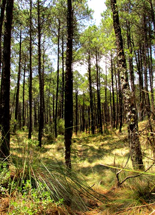
Notice that the pines all appear to be of the same age, with no young trees being established for the next generation, and that the forest floor is carpeted with dense clumpgrass. At the Reserve entrance an informative sign described the Reserve's history. You can see that sign below:
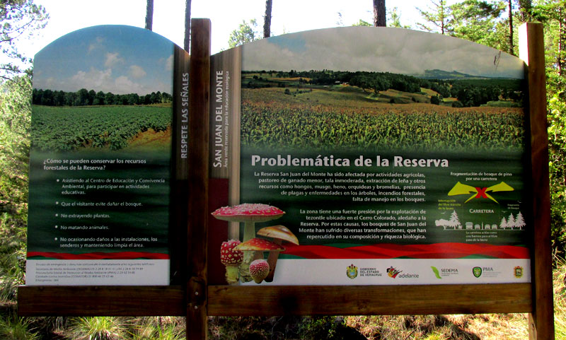
The sign informs us that "San Juan del Monte has been affected by agricultural activities, minor livestock grazing, immoderate tree-cutting, the gathering of firewood and other resources such as mushrooms, moss, hay, orchids and bromeliads, plus tree diseases, forest fires, and the lack of forest management." The sign goes on to speak of the special case of mining "tezontle" in the area of Cerro Colorado. Tezontle is a porous volcanic rock, usually reddish or blackish, typically sold as a small-grained gravel for roads and landscaping. I've seen it sold in bags at garden centers in the US.
A little deeper into the forest a large informational canvas suspended between trees provided more information. That canvas is shown below:
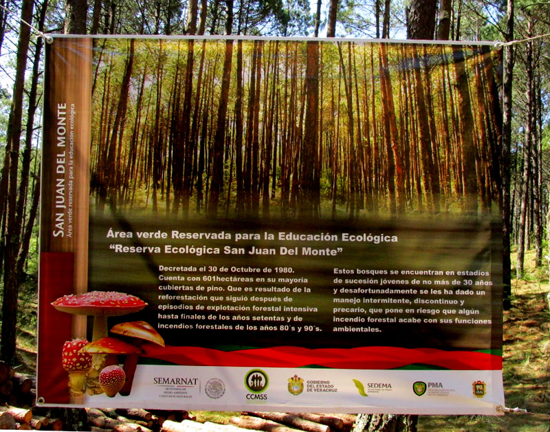
The canvas says that the Reserve, which covers 601 hectares (1485 acres), results from a decree made in 1980. The forest was intensively exploited up to the end of the 1970s, and suffered from forest fires during the 1980s and 90s. The forest is in a young stage of forest succession no more than 30 years old, and the canvas candidly admits that over the years the forest's management has been intermittent, leading to a precarious situation, especially with regard to forest fires. You can imagine what might happen during the dry season if the dry grass in the first photo is set ablaze.