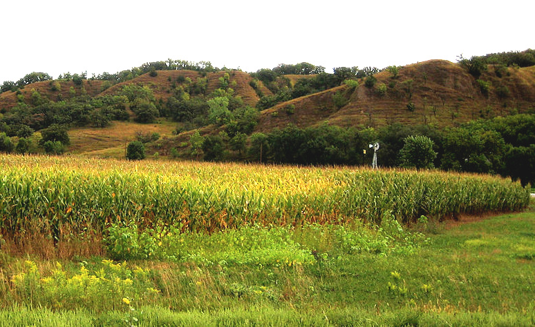
 Loess hills in Iowa; copyright free image courtesy of Bill Whittaker & Wikimedia Commons
Why did our loess fall atop the bluff and hilltops on the east side of the Mississippi River, and not elsewhere? There are no solid answers, though some good guesses have been proposed.
One reasonable-sounding idea could be called the moistened particle hypothesis. At the end of the last ice age, as dust-laden wind from the west flows across the Mississippi River, dust particles bump into water molecules suspended above the river. As more and more water molecules adhere to the dust particle, the dust gets heavier and descemds. This idea sounds better when we know that at the end of the last ice age the Mississippi River was an enormous "braided stream" with lots of surface area, as shown below.
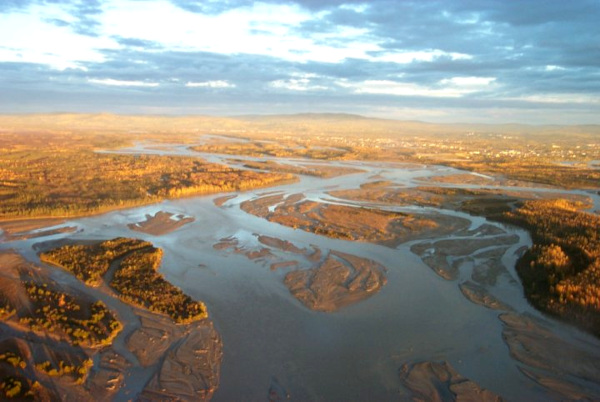
Many increasingly heavy dust particles drop into the braided stream network below them and are carried downstream, but others make it to the cliff on the plain's westward side. Lighter particles make it a little farther. Some make it ten or even twenty miles inland before they fall, and some just keep going.
Another educated guess might be called the lost energy hypothesis. This idea visualizes dust-laden wind from the west crossing the vast braided stream, which during winters include many drying-out mud flats which add to the dust. At the stream's eastern edge, the dusty wind encounters a steep cliff eroded into the uplands by the river. The cliff disturbs the wind's progress eastward.
In energetic terms, since the cliff provides friction to the wind above it, the wind must expend some of its energy to reorder itself to flow over the cliff. Having spent that energy, the wind loses some of its ability to hold dust particles in the air, and drops part of its load. As the wind moves across the upland landscape, more and more irregularities below it continue robbing energy, and more and more dust falls out, until eventually there's very little dust left.
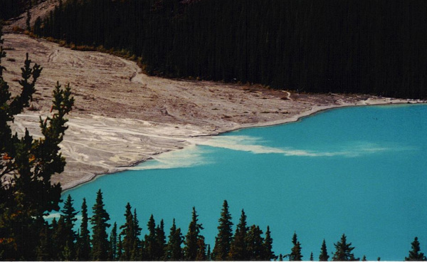
Earl Manning at Tulane University, building on the lost energy hypothesis, suggests a variation on the theme, one beginning with "rock flour," which is silt suspended in glacial water. The silt results when glaciers grind up rock being passed over. Rock flower accounts for the whiteness in the glacial meltwater seen below flowing into a lake.
Visualizing North America at the end of the last ice age, here's Manning's scenario, included in an email sent to Jim Conrad:
"Rock flour is washed out of the base of glaciers in southern Illinois by streams. Braided streams distribute the rock flour along the broad middle Mississippi River floodplain. Strong glacial winds (partly created by the cold of the glacial ice) blow down the valley, drying the floodplain, and picking up the silt... the winds were slowed by tall trees in forests along the lower Mississippi River Valley. The trees would baffle the wind enough to slow it. The forest explanation has the advantage of also explaining the basic wedge-shaped cross-section of the loess deposit along the river, thinning as it moves away from the river... The farther away from the water of the river you got in glacial time, the fewer trees. Therefore the less baffling, and the less loess falling out of suspension. In dry glacial time, the area beyond the river was more prairie than forest, like along the Platte today.
This is a good place to remind ourselves that the concepts of "bluff height" and "loess depth" shouldn't be confused. In the lower Mississippi River Valley, much of the height of bluffs and hills in the loess area is contributed not by loess, but rather by sands, gravels, and softer rocks such as siltstone, shale, marl, and nodular limestone lying below the loess. The accumulating loess just added height to them.