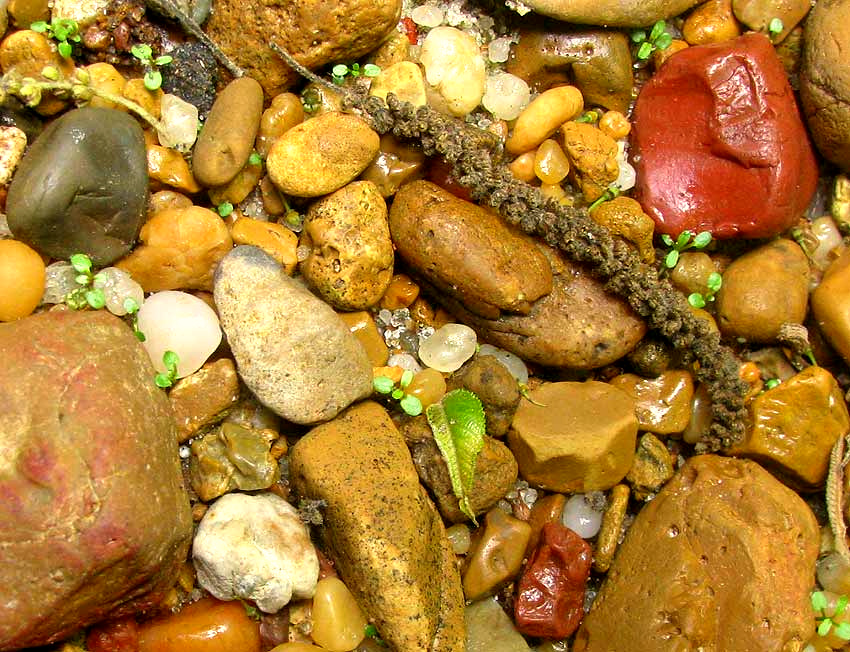
Also, the floor of the ravine/bayou may be covered alternately with mud, sand and gravel, the gravel eroded from the steep walls. It's an especially varied, colorful gravel, as shown above, and it's interesting stuff.
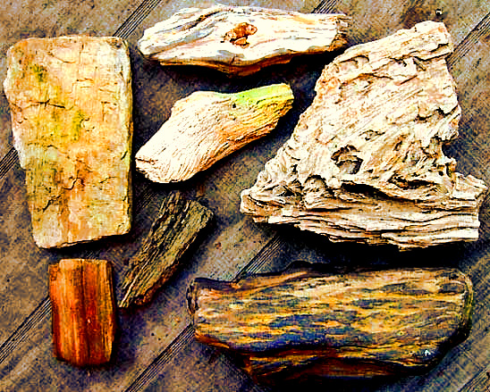
One point of interest is that in the Loess Hills' ravine/bayou-bottom gravel you can find semiprecious stones such as carnelian, quartz crystals and jasper. Besides that, there's petrified wood like that shown at the left, found in ravine/bayou bottoms near Natchez. Also there are fossils of other animals far, far older than the large mammals whose fossils are documented on our Loess-Zone Fossils page.
Happily, the history of our Loess Hills' stream-bed-bottom gravel is made clear in David Dockery's excellent, nicely illustrated and easy to understand Rocks and Fossils Found in Mississippi's Gravel Deposits. This can be freely downloaded by clicking on the title.
"Gravels in Mississippi streams are stones ripped from bedrock from as far away as the Nashville Dome area in Tennessee and the Appalachian Mountains of Alabama," Dockery tells us right off." Gravels of these ancient rivers are now perched in the hills and hilltops of northeastern, western, and southern Mississippi... They are ... the source of gravel in Mississippi's present-day rivers and streams."
Dockery makes clear that the age of the stone the gravel is made from -- not the pieces of gravel themselves -- ranges from 439 to 323 million years old, far older than any dinosaur.
The oldest ancient rivers carrying our Loess Hills stream-bottom gravel from Tennessee and Alabama into Mississippi did so 93.5-85.8 millions years ago. There was at least one other major gravel-transporting event. The most recent episode occurred only 5.5-1.7 million years ago. That gravel was deposited as the "Citronelle Formation" which, as seen in the map below, in the Loess Hills of southern Mississippi and northeastern Louisiana, is the geological unit lying directly beneath the loess.
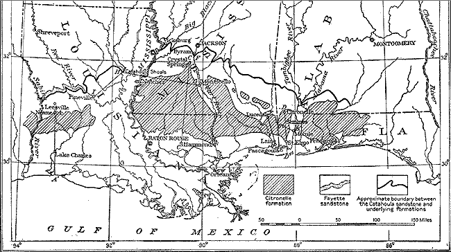 Citronelle Formation; public domain map by George Charlton Matson (1873-1921) made available by Wikimedia Commons
Thus, our silicate gravel ripped from Tennessee and Alabama bedrock 439 to 323 million years ago has been transported and retransported, the fragments tumbling, breaking and gradually being rounded and diminished in size, until now they repose calmly and prettily on our Loess Hills stream floors. Calmly, that is, until the next storm transports them a little father, rounding and diminishing even more, during the process surely begetting sandgrains for some future beach we can hardly imagine.