 April 7, 1988
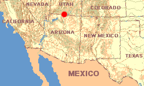
UTAH: Kane County
White House trailhead in Paria Canyon Primitive Area 30 miles northwest of Page, Arizona
April 7, 1988After half an hour on the road headed east toward Glen Canyon we pass a sign saying PARIA CANYON PRIMITIVE AREA VISITORS WELCOME. Having never heard of this place we keep going. But the ranger station atop a sand hill is nothing but a house trailer with a sign, with high canyon walls all around. The place seems to have soul. Pulling a Uy, we go back, for a buck buy a yard-high map of Paria Canyon, and register as a backpacker -- all without the slightest idea of what Paria is about.
At White House Trailhead I learn from a fellow hiker that Paria is famous among backpackers. The usual idea is to begin here and hike along the Paria River as it flows through a very deep canyon to the ranger station at Lee's Ferry, below the Glen Canyon Dam on the Colorado River, in Arizona, thirty-four miles to the southeast. My hiker-friend offers to transport me back here if I want to accompany him to Lee's Ferry, and I accept the invitation. But then he explains that much of the hike entails wading in the Paria's chilly water, so I decide to design my own dryer trip. I'll hike across the high tableland called West Clark Bench, enter Buckskin Gulch, then follow it until I can find a way out, and walk back across the bench. I'm told that Buckskin is dry. Maybe this is a five-day walk so I need to take plenty of water. Here's what happens:
APRIL 7
12:30 PM. Begin hike. Skies cloudless, temperature 80º.
12:35. An eleven-inch Western Whiptail, Cnemidophorus tigris, a light gray lizard with abundant dark spots, lets me take a good look as he lies in the shade of one of the smaller Sagebrush species. Smaller Side-blotched Lizard, Uta stansburiana, dart everywhere among the dark, hot rocks. We've met both of these species several times before.
2:30. A Whitetail Antelope Squirrel, Ammospermophilus leucurus, first seen at Big bend, lets me get to within ten feet. It's much smaller than I'd thought. As I sit looking at him, five White-throated Swifts circle above, twittering all the time.
4:00. The gently rolling landscape atop West Clark Bench is covered with deep, red sand that's very tiring to hike through. So, rather early for me, now I spread my poncho beneath a juniper; I'll sleep here tonight. We're at 5000 feet in elevation. Very common around this camp is a low-growing, spreading pricklypear cactus, the Plains Pricklypear, Opuntia polycantha. No blossoming wildflowers are found.
Thirty minutes before sunset, eight steel-blue Pinyon Jays glide by with their broad wings stiffly outstretched. All except one land in the scrub and remain silent; the other mounts to the very top of a juniper where it can see me and during ten minutes continuously calls a nasal, laugh-like auw-auw-auw.
APRIL 8
7:00 AM. Temperature 37º as I begin walking.
8:30. Having found a way down the vertical and usually unbroken cliff walls at the tableland's edge I drop to 4300 feet, to inside Buckskin Gulch. But the instant I see the Gulch's very bottom, I abandon my plan. Though Buckskin Gulch is a large canyon itself, here its streambed cuts through red sandstone rock a narrow, vertical-walled channel forty feet deep. As I lie on my stomach peering into the stream's trench, the wall opposite me stands not ten feet away. The streambed itself, where I'd planned to hike, lies in deep, perpetual shadows. Air wafting from this chasm-within-a-chasm smells dank, as if it were issuing from a dungeon. And, exactly where my eyes fall in this "dry" gulch, there's a deep-looking pool of stagnant, black water through which I'd have to wade if I happened to be down there...
Returning to the map to re-plan my walk, I find attached to it a previously unnoticed information sheet. It warns that Buckskin Gulch is very dangerous during rainy season. After rains, it says, flood debris has been spotted lodged between the canyon walls fifty feet above the stream bottom. The information sheet continues by saying that the deep, narrow valleys here result from the same Late Tertiary regional uplift that caused Zion to be so rugged. The sandstone walls around me right now, which manifest a curious, swirling design, is the Navajo Sandstone, deposited between 130 and 200 million years ago when this part of the world was covered with desert. The sand in these cliff walls once was sand in sand dunes, and the swirl-patterns reflect those ancient dunes' growth and movement.
10:30. Having retraced my steps to the tablelands at 5000 feet, I find myself drenched with sweat. Though the temperature in the shade is 60º, the wind causes my wet clothing to feel icy cold. I hang them to dry on a juniper snag. Wherever the sun hits my body it stings with incredible intensity but on the shadowed part of my body I'm desperately cold. With the view below me stretching across rugged land far into Arizona to the south, and the wind and sun hitting me almost harder than I can bear, I feel as if I am at the end of the world.
Noon. The plateau rises gradually to a little over 5200 feet. Suddenly our old friend from the Sagebrush desert near Kanab, the Whipple's Cholla, Opuntia whipplei, appears in abundance. Also common here is the Fineleaf Yucca, Yucca angustissima,an almost trunkless species with stiff fibers curling away from the margins of dagger-like leafblades.
2:00. At 4600 feet, as I descend through Long Canyon, a southerly slope provides an unexpected garden of intermingling, foot-tall, blue-flowered lupines and intensely red-blossomed Utah Penstemon, Penstemon utahensis. An inconspicuous little mustard with tiny yellow blossoms, called Longbeak, Streptanthus cordatus, grows at the garden's edge. Rain must have fallen here a week or so ago, for slender, pale-green grassblades push up through the sand, and various other wildflowers are just germinating. On this steep-walled canyon's rocky slopes lives a strange-looking ash tree called the Singleleaf Ash, Fraxinus anomala. It bears no leaves now but some of last year's fruits, called samaras, still hang on it. Anyone familiar with ashes knows that ashes are supposed to produce compound leaves composed of several leaflets, and not be "single-leafed," as this one is.
APRIL 9
Having exhausted my water last night, at 11:00 AM after walking all morning without a drink, I return to Henry at White House Trailhead and for twenty minutes just sit in the door drinking pure, cold water from a white Chlorox jug.