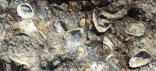
Fossil shells in limestone at Río Lagartos, Yucatán
In general, the northern Yucatan Peninsula is characterized by these five notable features:
THE YUCATAN IS LOW AND FAIRLY FLATYou can think of the Peninsula as a big slab of limestone gently slanting into the sea. The farther south you go, the more likely you are to encounter low hills. By the same token, you must travel far offshore before you reach deep water. If you travel Hwy 24 between Mérida and Campeche you'll see some hills just to the east of the highway but the highest peak there is only 108 meters (354 feet). Farther inland, near Tekax, the highest hill, Cerro de Xal, is 250 meters (820 feet). The hills in this area are often called the Puuc Hills. Down south where the peninsula joins the mainland's body there are other peaks just north of Hwy 186 running between Chetumal and Francisco Escárcega reaching 250 meters and a bit more. THE BEDROCK IS LIMESTONELimestone is soluble in water so the Yucatan's limestone bedrock is honeycombed with caves and sinkholes -- it's classic karst topography. Yucatan's sinkholes have a special name -- cenotes (seh-NO-tehs). Cenotes are the result of caves collapsing, forming holes in the ground with water in the bottoms of the holes. Because the limestone has so many holes in it, there are no major rivers throughout the entire Yucatan Peninsula. Water runs underground. THE LIMESTONE HAS MANY CAVES AND CENOTESCenotes are very important in Yucatan history and present life. Because of the lack of rivers, the ancient Maya took their water from cenotes. Cenotes were important in the Maya religion, being the home of gods. Sometimes humans were thrown into cenotes as sacrifices. Today underwater archeological teams are discovering many Maya artifacts in cenotes. Also, many divers enjoy exploring the Yucatan's cenotes and underground rivers. THE LIMESTONE IS YOUNG, GEOLOGICALLY SPEAKINGMuch of the outcropping limestone in the northern Yucatan is part of the Carrillo Puerto Formation of Miocene-Pliocene age. The Miocene and Pliocene are often considered as having occurred from 23.8 to 1.8 million years ago. Along much of the Yucatan coastline you find Quaternary deposits 1.8 million years old and younger. THE CHICXULUB IMPACT CHANGED LIFE ON EARTHAbout 65 million years ago a large asteroid or comet hit the part of the Earth that later would be occupied by the northwestern Yucatan Peninsula. The city of Mérida lies inside that zone. Today the impact zone is referred to as the Chicxulub Crater, though there is no crater or any other obvious evidence of the impact to be seen. The impact's crater is buried beneath 65 million years of sediment, much of which now has solidified to limestone. One reason the Chicxulub impact is of such interest is that it is thought to be responsible for the vast extinction of species that took place 65 million years ago. At that time dinosaurs were the Earth's most advanced form of life. The Chicxulub impact changed the Earth's weather conditions so drastically that all the dinosaurs died off. This enabled mammals to assume the dinosaur's dominant position. Had it not been for the Chicxulub impact, we humans may not have evolved as we did, or evolved at all. You can read a lot more about the Chicxulub Crater, see an animation of how the crater was formed, read about regional and global effects of the impact, and find more links on the matter at the NASA/University of Arizona Chicxulub website. |