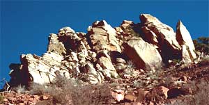
 First
of all, most of the readers of these words probably live atop trucked-in dirt, or dirt
that has been scalped and leveled by large machines. Therefore, here we're using he term
"backyard" in a figurative sense, meaning "in the general neighborhood, or
at least in the region," where surely someplace something like the mysterious
outcropping at the right must exist. Having understood that, here are some insights into
"backyard geology."
First
of all, most of the readers of these words probably live atop trucked-in dirt, or dirt
that has been scalped and leveled by large machines. Therefore, here we're using he term
"backyard" in a figurative sense, meaning "in the general neighborhood, or
at least in the region," where surely someplace something like the mysterious
outcropping at the right must exist. Having understood that, here are some insights into
"backyard geology."
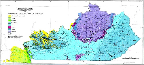
Using Geology Maps
Geology maps can tell us what kind of geology to expect in our areas. Take a look at our generalized geology map of the US. That map is gorgeous but it doesn't tell us much without the color-coded key that goes with it. I'm not providing it here because on a computer screen it's almost impossible to match the colors. The map is presented just to show you an example of a geology map, and so you can get a little practice using one.
For example, on that map I grew up on a farm in the very center of the gray area shown in the central part of western Kentucky. (Kentucky is that state in the middle of the eastern US, shaped like a club, with the Ohio river forming its meandering northern border). The map shows that the same geological unit on which I grew up extends way into Illinois. The color key provided with the map says that the gray area denotes areas of outcropping rocks of Pennsylvanian age -- rocks 290-323 million years old. And books tell me that Pennsylvanian rocks in that part of the world are mostly coal-bearing sandstone, with a little shale and a tiny bit of limestone.
Well, my wanderings there confirm that all that is perfectly true. There's a lot of coal mining in my home area, as it is in southern Illinois, and the fossils I found there as a kid are Pennsylvanian-age ones.
The more local your map is, the more specific the information can be for your local area. Below is a typical geology map for a US state, that of Kentucky, presented here with thanks to the Kentucky Geological Survey..